Example of grasshopper evolutionary model, exploring relation between building form based on a parcel’s given shape.
The graduate research project proposes a bottom-up approach to explore the relationship between land-use and building form - how does building form respond to a defined parcel shape? Using a building typology index, an evolutionary model was developed to simulate how potential building forms could occupy a given parcel based on its shape. The parameters used to determine these forms were based on geometric domains that reflect different typologies within the context of the City of Vancouver. Additional formal parameters were integrated to consider passive design strategies and economies of scale, which provide cause-grounding for the research.
Initial research entailed the development of a syntax tree to describe the possible forms that occupy a given parcel, based on two criteria: first, its spatial contiguity, and second, its mode of internal circulation. This would determine how a generic form could ideally grow into more complex shapes to fit different land-uses and larger parcel geometries, creating the building typology index.
This research tied into the PICS project’s overall strategy to search for metabolic indicators to reduce energy consumption at the urban planning level. The goal was to provide tangible indicators for policy makers to make informed decisions on future urban scenarios.
Company
elementsLab
Location
Vancouver, Canada
Typology
Urban and Building Design
Funding/Grants
Pacific Institute of Climate Studies (PICS), National Science and Engineering Research Council (NSERC)
Research Workflow
Grasshopper based Python Scripts, utilizing Octopus
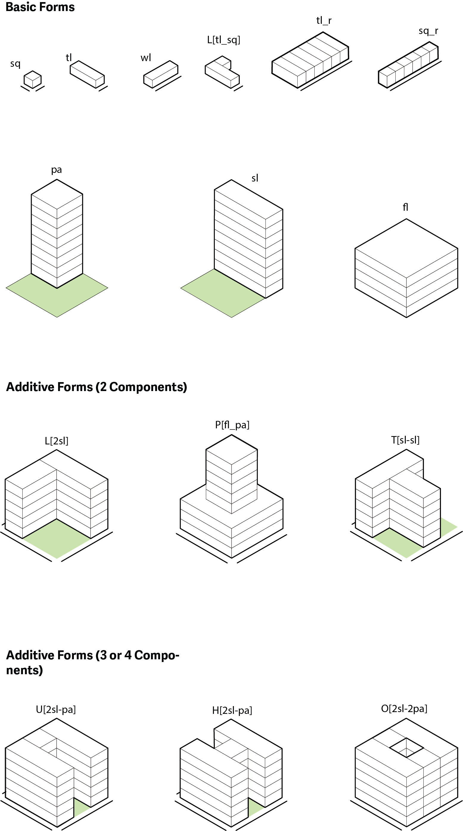
typology index - including naming and formatting
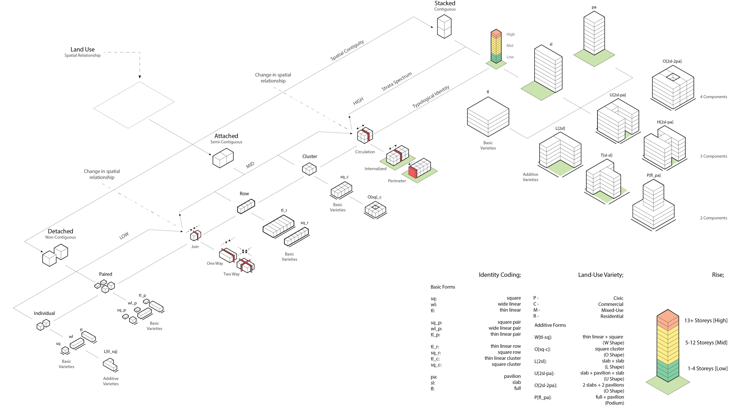
typology syntax tree - categorizing building types through identifiable formal boundaries and growth
A grasshopper + python script was created to simulate possible building forms on a parcel, given its land use and zoning envelope. This script would first determine which syntax branch would likely occupy the parcel, then form fit within the determined zoning envelope. This script would use an evolutionary simulator to determine a range of potential generic building forms. Successful forms would be given generic floor plates and fenestration within its mass. the final step would extract numeric data that could be attached to the geometry, and stored into a database.
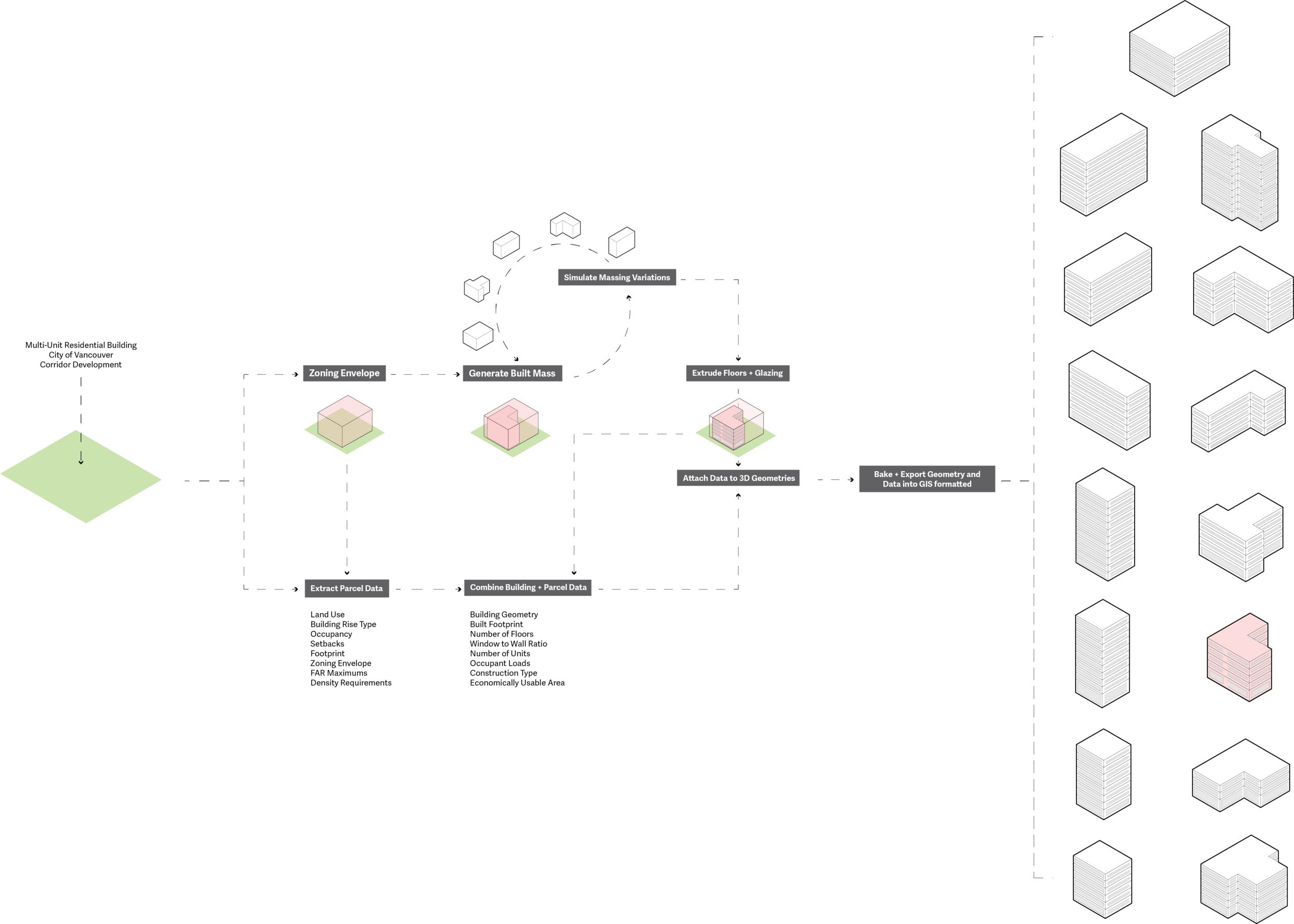
process for typology generation on a given parcel with data extracted to excel
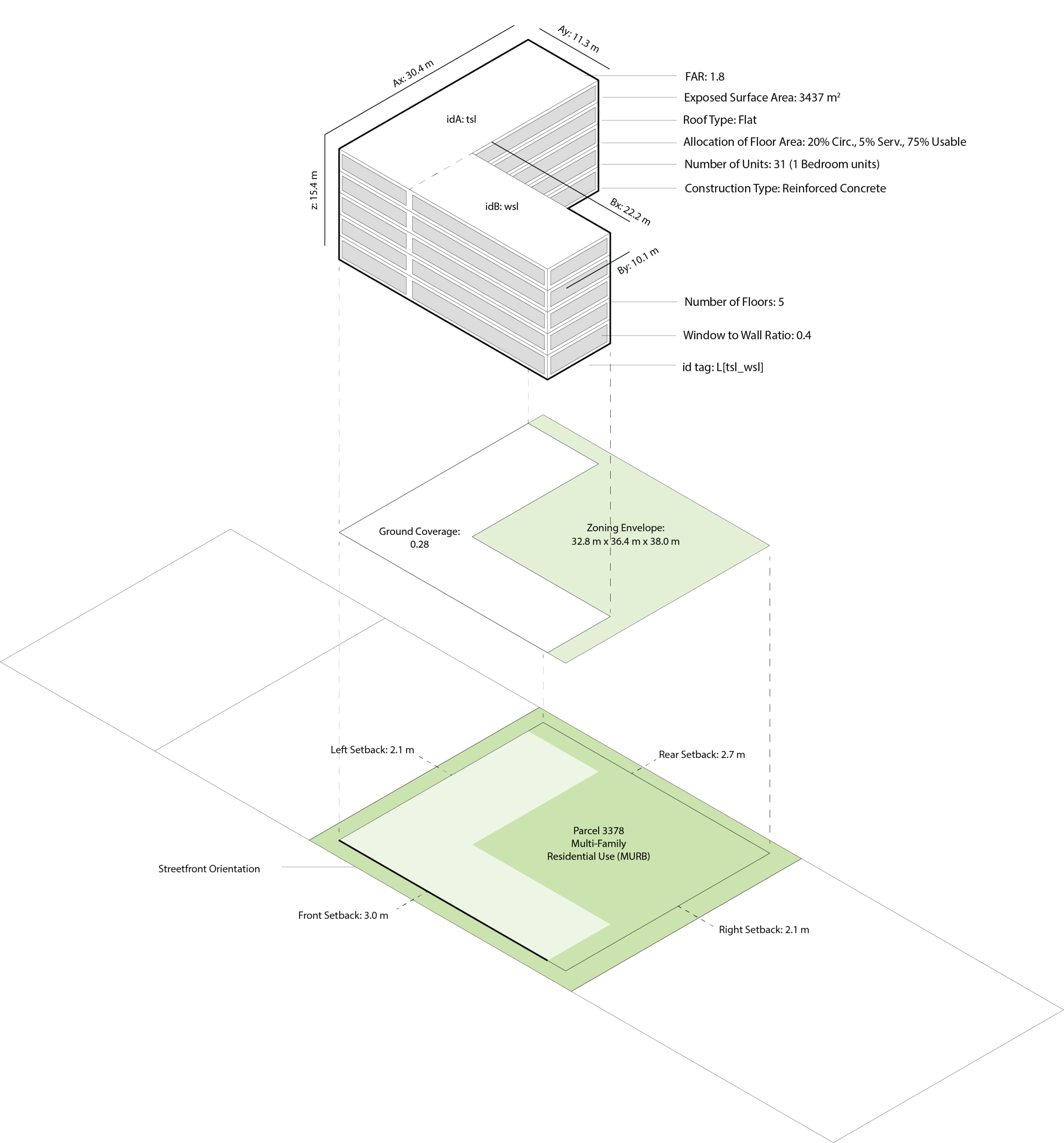
metadata integrated within each evolutionary solution
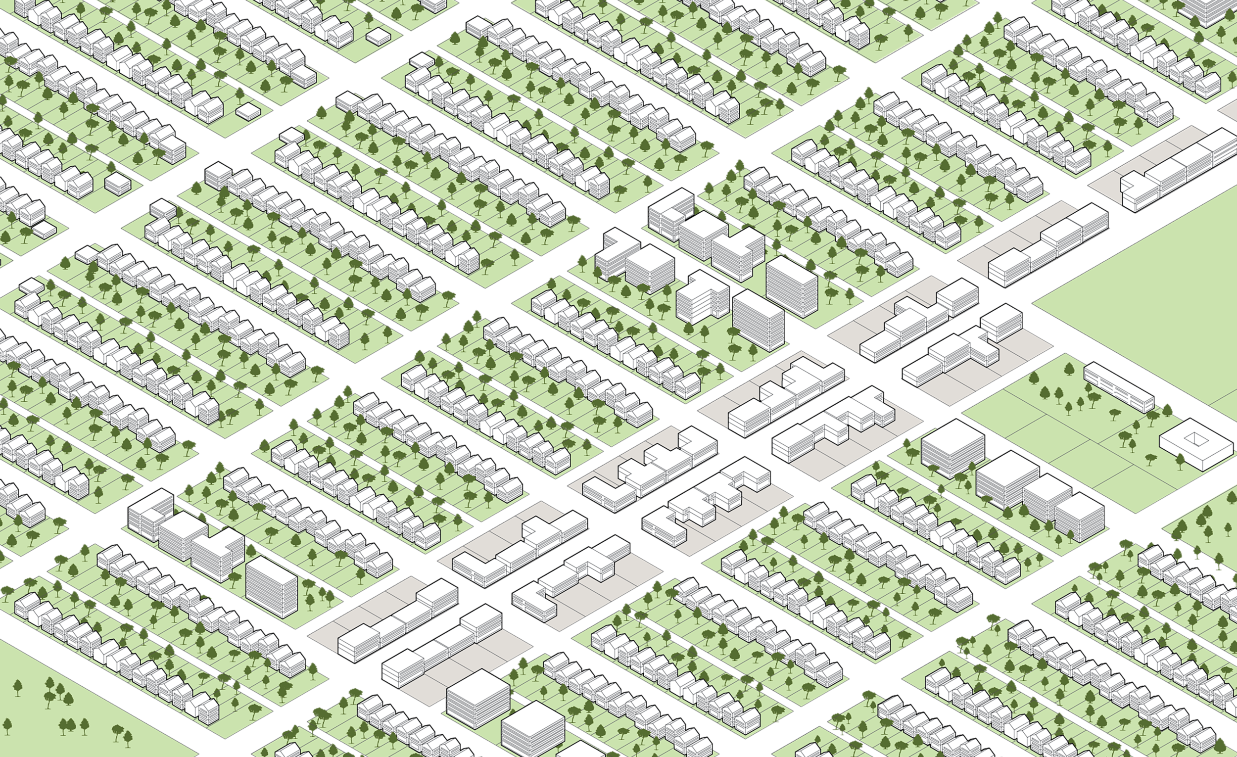
The goal of the evolutionary modelling was to provide a flexible database of potential building forms that could populate a given parcel. Forms then can be selectively chosen to populate a parcel, based on embedded data within the database. These populated parcels would then create a possible neighbourhood scale configuration (known as a superpatch), to help generate simulated urban energy metabolisms by 2050.
These speculative superpatch neighbourhoods would indicate cause-grounding for policy makers to make informed decisions regarding urban livability, affordability, and energy metabolism as part of an integrated system.